

Dobrý den je tato navigace kompatibilní se radarem SR30
iGET CYCLO C250 GPS, navigation

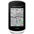
GPS Navigation - designed for bicycles, hiking, 2.2" display, 320 × 240 resolution, includes thermometer and altimeter, maps of Czech Republic + Europe, cycling functions: actual speed, max. speed, current driving time, distance travelled, total driving time and autostart/stop, features: touch display, battery life 22 h, Android and iOS OS compatible, connectivity over Bluetooth, WiFi and ANT+, holder and rechargeable batteries included in package, black case colour, dimensions 85 × 53 × 19 mm (H×W×D), weight 90 g
Show full description
Code:
SPTiget16
Don't like the alternatives? Choose from the full product list
- Reviews 5
- Help and manuals 14
- Specifications
- Photos & Videos 7
- Alternatives 1
- Accessories and suggested products

iGET CYCLO C250 GPS, navigation
Discontinued
iGET CYCLO C250 GPS, navigation
Do you often need to find an alternative route to avoid traffic jams? The iGET CYCLO C250 GPS, navigation GPS Navigation is here and ready to solve all your problems. It will always tell you the fastest route, so you can reach your target in the quickest time possible. Just enter your destination and you are ready to go! This practical GPS system features an easy-to-read colour display with a diagonal measuring 2.2" and a highly-detailed 320 × 240 resolution. The screen also has a full touch functionality, so it's easy to use.. iGET also augmented the GPS with a battery that will last you 22 hr(s). The GPS system measures 85 mm × 53 mm × 19 mm with a weight of 90 g.
The GPS Navigation iGET CYCLO C250 GPS, navigation - Gives You the Best Possible Start to Your Journey
The iGET CYCLO C250 GPS, navigation GPS navigation comes with complete maps of the whole Czech Republic plus voice directions in Czech. You will also get a complete map of all the roads in Europe, so you can find the best route when you are trying to find your holiday destination.
iGET CYCLO C250 GPS, navigation GPS System Key Features
- An easy-to-read display measuring 2.2"
- 22 hr(s) battery life
- Uses Bluetooth to connect to your mobile phone
- Maps covering the whole of Europe and the Czech Republic
The iGET CYCLO C250 GPS, navigation model also includes some rather exceptional features that improve your user comfort. You can connect the GPS to your phone using Bluetooth.
Specifications
Dimensions
Width
Height
Depth
Weight
Weight
Navigation type
Cycling, hiking
Hardware and Software
2.2" (5.59 cm)
320 × 240
OS compatibility
Connectivity
Sensors and detectors
Sensors
Battery life and memory
22 h
Equipment and features
Accessories
Functions
Cyclofunction
Cyclofunction
Languages
Interface Language
Color and finish
Case colour
Degree of protection
Package contents
Included
Compatibility
OS compatibility
Connectivity and navigation
Connectivity
Data Transfer
GPS
Battery and display
Max. Battery Life
Display diagonal
Display size
Dimensions
Width
Height
Depth
Weight
Weight
Packaging
Included
More Specifications

INTELEK LTD, organizační složka, Ericha Roučky 1291/4, Brno, 627 00, Czech Republic, www.intelek.cz, 533 338 858, [email protected]
Note:
Specifications can be changed without notice. Images are for illustrative purposes only.